[Report 1960] / Medical Officer of Health, Northampton County Borough.
32/128
15 (canvas 33)
The image contains the following text:
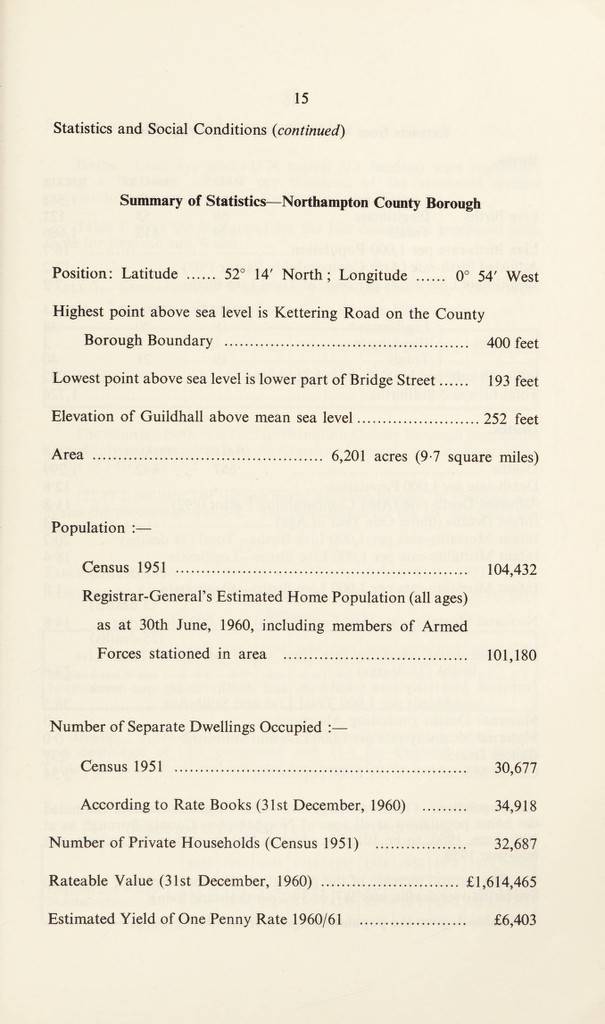
Statistics and Social Conditions (continued)
Summary of Statistics—Northampton County Borough
Position: Latitude . 52° 14' North; Longitude . 0° 54' West
Highest point above sea level is Kettering Road on the County
Borough Boundary . 400 feet
Lowest point above sea level is lower part of Bridge Street. 193 feet
Elevation of Guildhall above mean sea level. 252 feet
Area . 6,201 acres (9-7 square miles)
Population :—
Census 1951 . 104,432
Registrar-General’s Estimated Home Population (all ages)
as at 30th June, 1960, including members of Armed
Forces stationed in area . 101,180
Number of Separate Dwellings Occupied :—
Census 1951 . 30,677
According to Rate Books (31st December, 1960) . 34,918
Number of Private Households (Census 1951) . 32,687
Rateable Value (31st December, 1960) . £1,614,465
Estimated Yield of One Penny Rate 1960/61 . £6,403